
I have been working on a few projects lately and failed to update with any information. But that doesn’t mean I haven’t found anything new and interesting!
Many people may have seen this already, but I just discovered these maps of Middle Tennessee, and Stewart/Houston/Humphreys/Montgomery Counties in particular. The main page where I found the link for them is Stewart County, Tennessee Genealogy.
So, the maps are actually postal maps from 1865. They show the locations of nearly every head of household, or at least land owners, in the area. I printed them out so I could scour them without squinting at my screen and I found Basil Pinkney Summers! Well, technically I found a few “Sumers” on there, but one I know is definitely him. The first one I noticed is on the south bank of White Oak Creek.

You will also notice that there is a “Sumers Mill” at the north bank, but I’m not certain as of right now if my Summers had anything to do with that. Basil Pinkney’s grandfather Basil was deceased by 1865, so I don’t really know who this B Sumers is, unless Basil Pinkney owned this land in addition to another plot.
Now, I did find land Basil Pinkney definitely owned.

This land is located on the north bank of White Oak Creek, just downstream from “Sumers Mill”. Something interesting I want to point out here is just downstream from Basil Pinkney on the south bank is “Wid E Sumers”. Basil Pinkney died in 1878, so he was definitely still alive in 1865. I’m not sure who that widow is.
Anyway, how do I know that the north bank B Sumers is Basil Pinkney for sure? Well, land records of course!
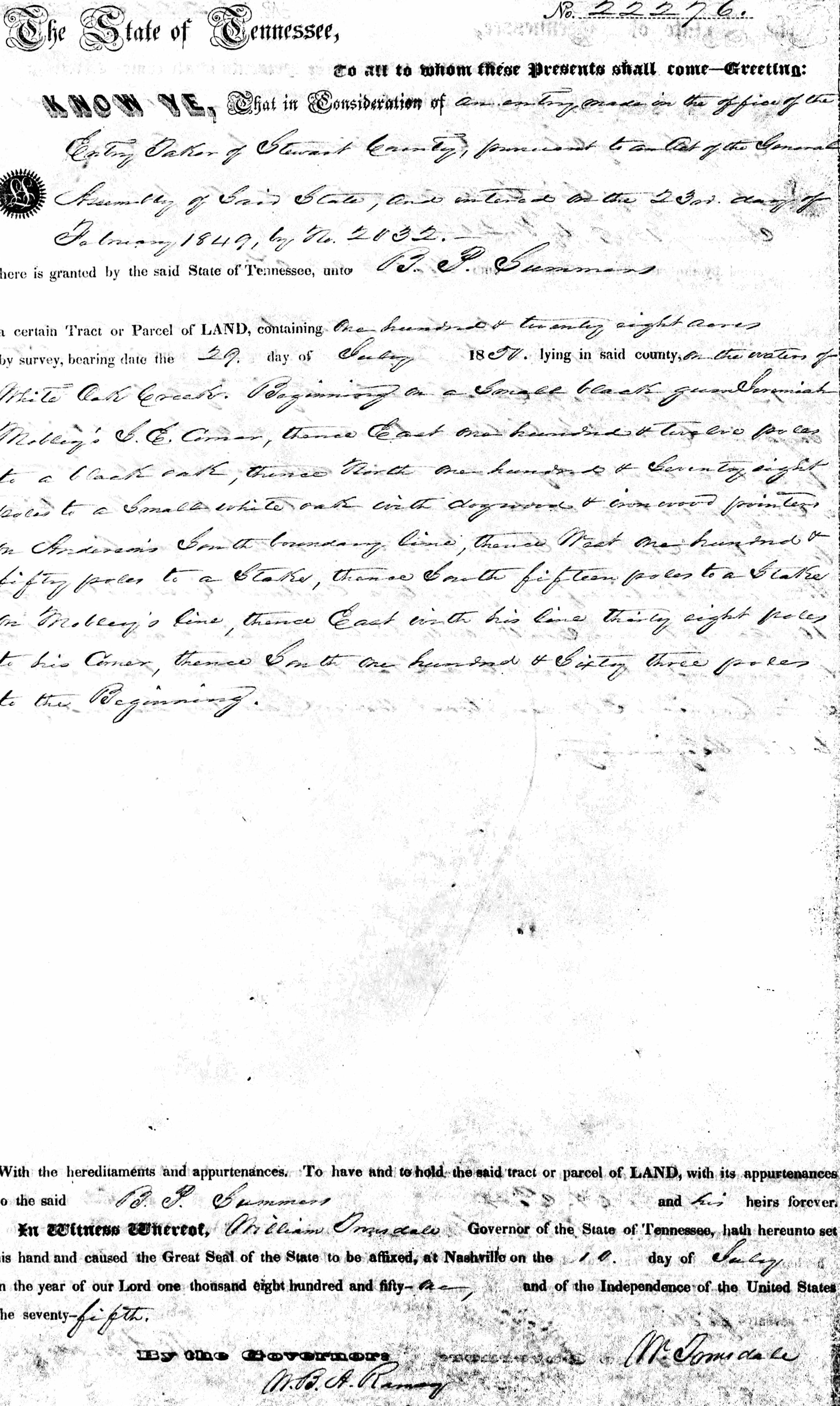
This I found on Ancestry. It is a North Carolina and Tennessee, Early Land Records, 1753-1931 for BP Summers dated July 10, 1851 in Stewart County, Tennessee (this location would eventually be in Houston County, Tennessee in 1871). I know, it’s hard to read. The transcription of the location of Basil Pinkney’s land:
…one hundred & twenty eight acres…on the waters of White Oak Creek. Beginning on a small black (illegible) Jeremiah Mobley’s S.E. Corner, thence East one hundred & twelve poles to a black oak, thence North one hundred & seventy eight poles to a small white oak with dogwood & ironwood pointers on Anderson’s South boundary line, thence West one hundred & fifty poles to a stake on Mobley’s line, thence East with his line thirty eight poles to his corner, thence South one hundred & sixty three poles to the Beginning.
So, based on the description it is easy to see that the land described is definitely on the north bank. Since people moved and died over the 14 year period between the land record and the map, it’s difficult to see where exactly Mobley and Anderson where living.
Now, to figure out who the other “Sumers” are!
